
The Gjellestad Ship Burial

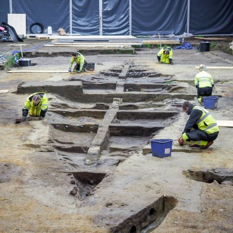
Ground Penetrating Radar in progress. The inset shows the ship burial
image: NIKU (Norsk institutt for kulturminnforskning)
Your content goes here. Edit or remove this text inline or in the module Content settings. You can also style every aspect of this content in the module Design settings and even apply custom CSS to this text in the module Advanced settings.

Location Map (BBC)
(click on the images to enlarge)
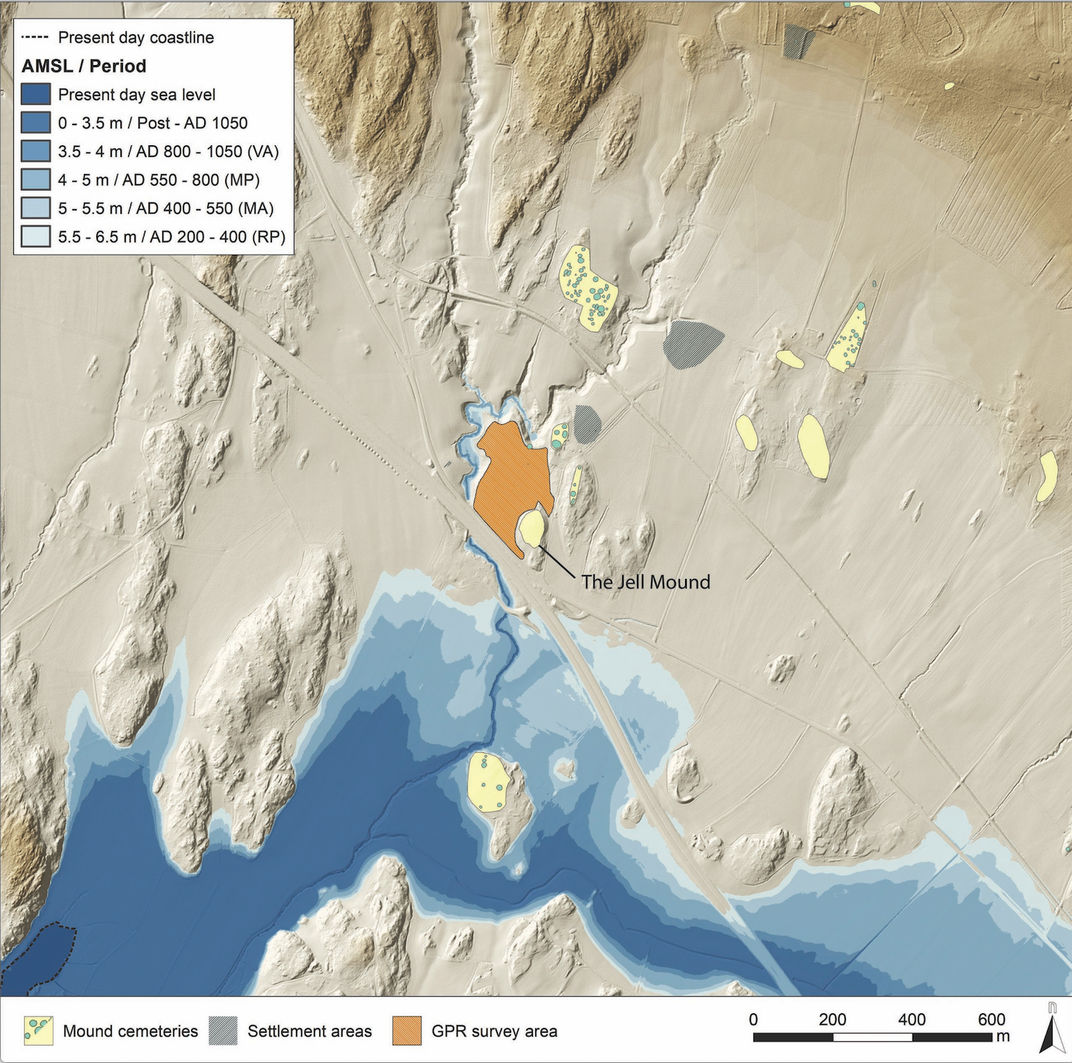
Location map of the GPR survey area at Gjellestad
(map source: © Kartverket/CC-BY-4.0; figure by L. Gustavsen)
The ship under excavation
image: NIKU (Norsk institutt for kulturminnforskning)
Your content goes here. Edit or remove this text inline or in the module Content settings. You can also style every aspect of this content in the module Design settings and even apply custom CSS to this text in the module Advanced settings.